Home > Edge > Digital Cities Edge > White Papers > Dell Validated Design for Urban Mobility with ISS - White Paper > GIS map layer
GIS map layer
-
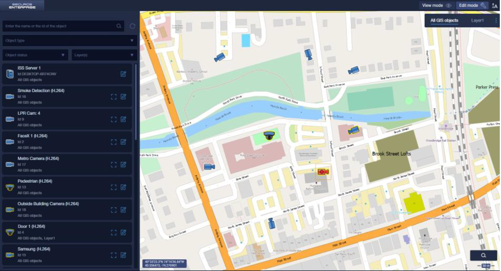
The SecurOS GIS is an effective tool for visualizing the location of security devices, such as cameras, two-way communication devices, and access control (ACS) devices on a GIS map, and for the prompt processing of alarm events coming from these devices.
The module can effectively monitor large and extended areas with thousands or tens of thousands of devices in the SecurOS distributed security system and keep track of events that threaten the safety of sites and people. Being a native system to the SecurOS video management platform, SecurOS GIS supports the Media Client, which is a SecurOS interface for working with video and audio data. Pairing the interfaces allows the user to respond quickly to incidents.

Figure 2. SecurOS GIS interface
Some of the key functionalities of this module include:
- Searching for a device and navigating to the selected device on the map.
- Viewing information about the device (object ID and type, current status, being bound to a layer, and the geographical coordinates of the current device location).
- Switching to video playback.
- Orienting the camera on the map (manually) by its actual field of view.
